 lat 33°20’02.05” N, long 79°11’34.62” W
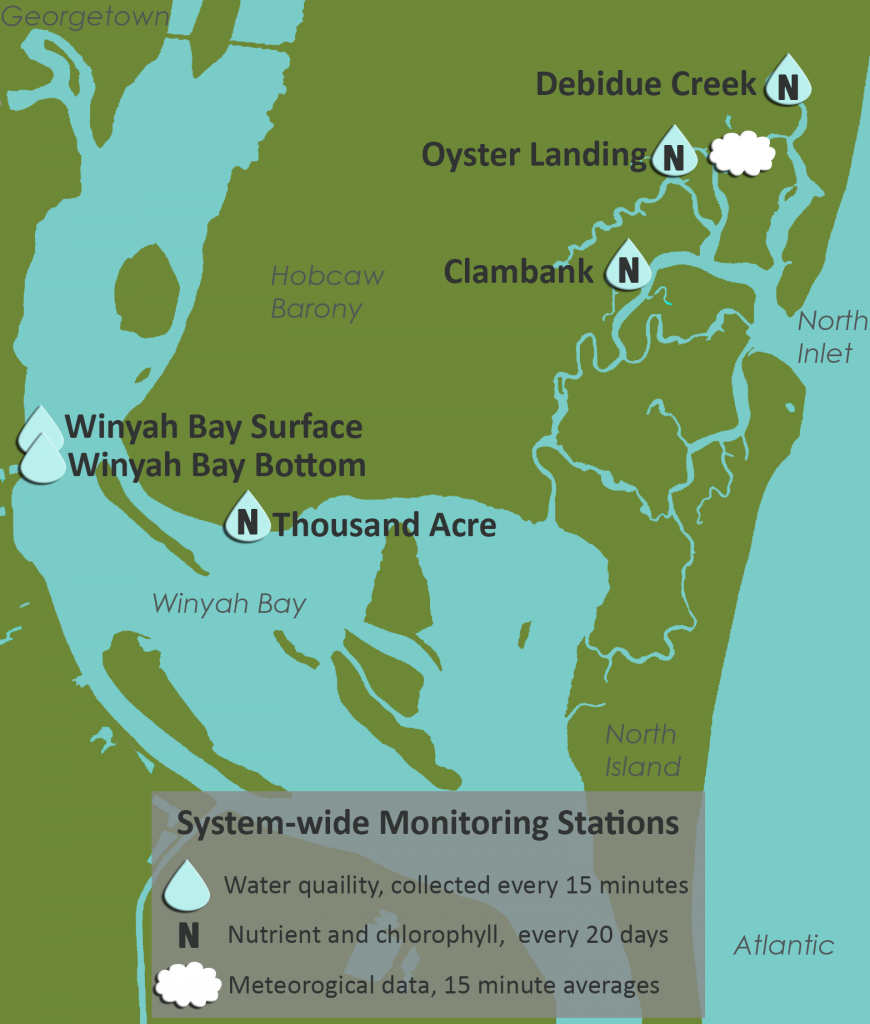
The Clambank Landing monitoring site is located roughly in the center of the reserve boundary. This site is surrounded by a Spartina alterniflora marsh and does not drain a defined sub-basin of the North Inlet estuary (as is the case for Crabhaul and Debidue Creeks). It is predominantly influenced by oceanic waters due to its close proximity to North Inlet, but is occasionally influenced by water entering from Winyah Bay at the creek’s southern end. Salinity has ranged from 5 to 39, with a long-term average of 33. This site is considered relatively pristine and is influenced by its close proximity to the Inlet mouth. Water quality, nutrient and chlorophyll monitoring was initiated at this site in 2001.
 lat 33°21’36.49” N, long 79°10’02.81” W
The Debidue Creek monitoring site is located in an ocean-dominated Spartina marsh that was formerly surrounded by pine-dominated uplands. The site is approximately 1 km south of the Debordieu Colony, a large development built on man-made canals that drain into the northern portion of Debidue Creek, and as a result, may be considered an anthropogenically impacted site. Salinity has ranged from 0 to 36 with a long-term average of 33. Water quality, nutrient and chlorophyll monitoring was initiated at this site in 1998.
 lat. 33°20’57.70” N, long. 79°11’19.97” W
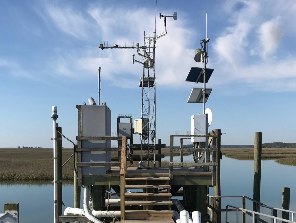
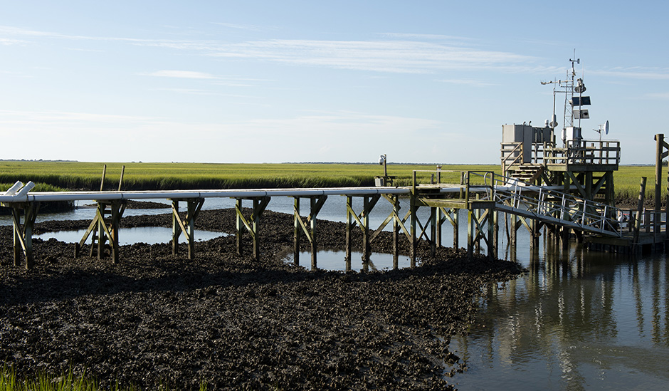
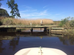
The Oyster Landing monitoring site is located near the western, upland edge of the North Inlet basin, at the confluence of two 1st order tidal creeks: the upper reaches of Crabhaul Creek and a much smaller un-named creek that directly drains pine forested uplands and wetlands. The sampling site is approximately 2.8 km from the terminus of Crabhaul Creek. The vegetation of the Crabhaul Creek sub-basin is dominated by Spartina alterniflora that transitions into salt pan, Juncus roemerianus and mixed vegetation communities along its upland edge. At the monitoring site the creek has an average depth of approximately 2m at MHW. The average tidal range is about 1.4 m. Salinity has ranged from 0 – 39, with a long-term average of 32. The site is considered to represent relatively pristine conditions due to the absence of significant disturbance in its drainage area. Water quality, nutrient and chlorophyll monitoring was initiated at this site in 1993. This is also the site of the NERR’s meteorological station.
 lat. 33°17’57.03” N, long. 79°15’21.75” W
The Thousand Acre monitoring site is located approximately 15 m from the mouth of a creek that drains a tidal brackish marsh that empties into the northeastern side of the mid-portion of Winyah Bay. The marsh, which is now dominated by brackish plants such as Spartina cynosuroides was formerly impounded for rice cultivation. Rice cultivation was abandoned prior to the Civil War. The upland drainage consists of undeveloped pine forest and forested wetlands. At the monitoring site, the creek depth is approximately 2 m at MHW with an average tidal range of approximately 1 m. Salinity has ranged from 0 to 33, with a long-term average of 8.5. While the creek drains marsh and undeveloped uplands on ebb tides, it receives degraded Winyah Bay water on flood tides and is therefore considered an impacted site. Water quality, nutrient and chlorophyll monitoring was initiated at this site in 1993.
 lat. 33°18’33.88” N, long. 79°17’19.57” W and lat. 33°18’33.94” N, long. 79°17’19.58” W respectively
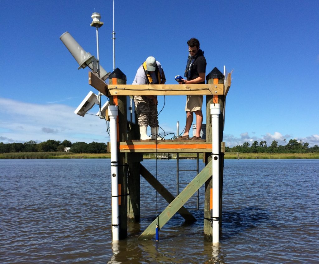
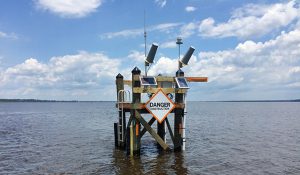
The Winyah Bay monitoring site has both a surface water sonde (WS) and a bottom water sonde (WB). The site is located in the mainstem portion of Winyah Bay, on the western edge of the natural channel adjacent to Frazier Point Bend. This is roughly 6 km down-bay of the confluence of the Black, Pee Dee and Waccamaw rivers and 4 km down-bay of the mouth of the Sampit River and the City of Georgetown. This monitoring station is located to represent the collective inputs to Winyah Bay from its anthropogenically-impacted watershed. Water depth at the station is on the order of 5 m at MLW. Tidal range is approximately 1 m and the site exhibits salinity stratification, especially on flooding tides. The sondes are maintained at fixed depths of approximately 0.2 m below the surface at MLW (WS) and approximately 1 m above the sediment surface (WB). As water quality monitoring was only initiated at this site in May of 2016, long-term average salinities and tidal datums have not yet been established.
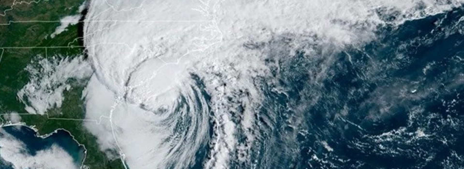
Storm Story: Hurricane Ian
Storm Stories use Data to Communicate Hurricane Impacts Storm Stories was developed through a NERR Science Collaborative Transfer Grant. The past several years of extreme